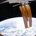
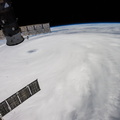
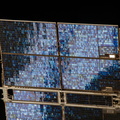
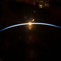
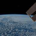
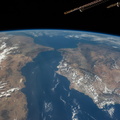
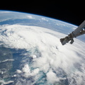
 on July 3, 2014 projected it hitting the coast of North Carolina as a Category 2 hurricane, with winds over 100 mph, on the night of July 3 or the morning of July 4. A tip of one of the solar panels on the orbital outpost is in upper left.")
WIKIARCHIVES.SPACE
The Human Spaceflight Archive


Information
- Taken in
- Space
- Author
- NASA
- Description
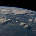
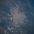
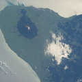
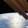
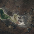
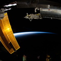
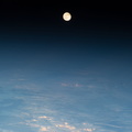
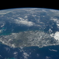
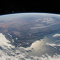
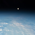
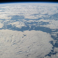
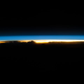
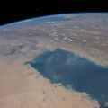
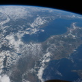
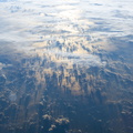
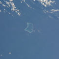
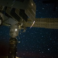
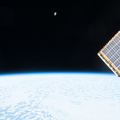
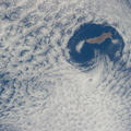
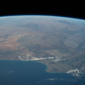
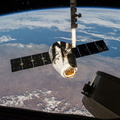
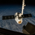
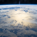
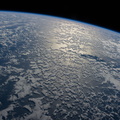
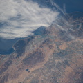
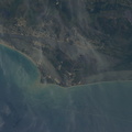
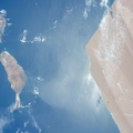
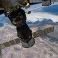
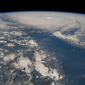
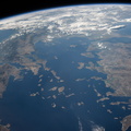
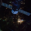
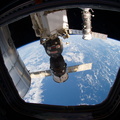
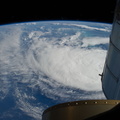
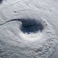
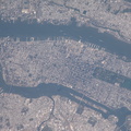
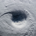
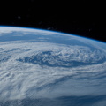
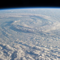
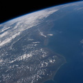
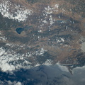
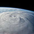
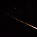
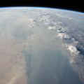
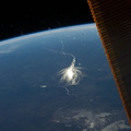
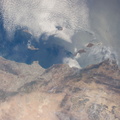
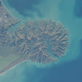
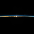
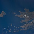
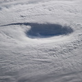
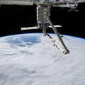
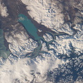
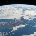
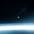
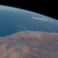
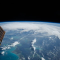
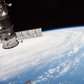
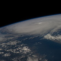
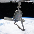
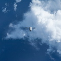
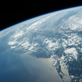
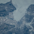
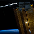
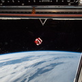
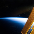
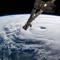
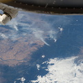
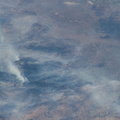
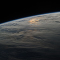
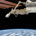
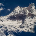
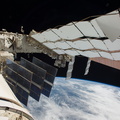
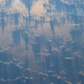
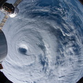
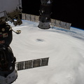
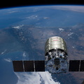
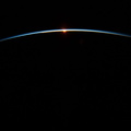
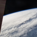
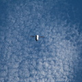
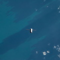
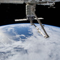
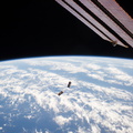
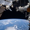
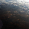
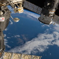
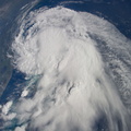
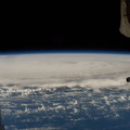
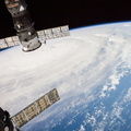
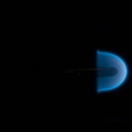
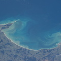
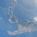
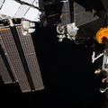
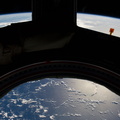
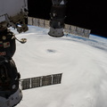
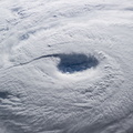
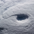
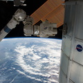
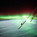
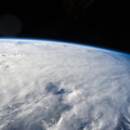
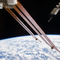
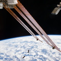
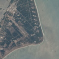
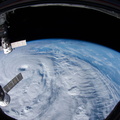
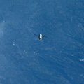
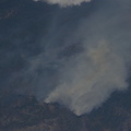
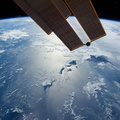
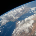
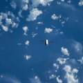
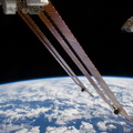
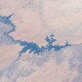
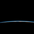
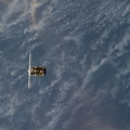
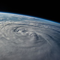
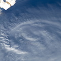
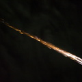
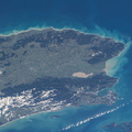
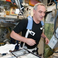
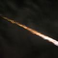
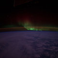
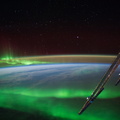
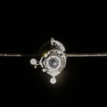
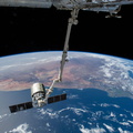
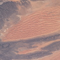
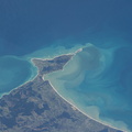
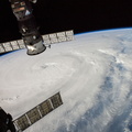
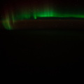
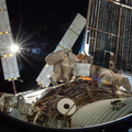
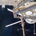
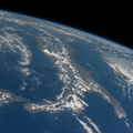
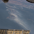
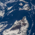
- As the International Space Station was flying 227 nautical miles above the Bahama Islands, one of the Expedition 40 crew members photographed this image of Hurricane Arthur, moving northerly along the Atlantic coast line. Arthur's forecast at 11 a.m. (EDT) on July 3, 2014 projected it hitting the coast of North Carolina as a Category 2 hurricane, with winds over 100 mph, on the night of July 3 or the morning of July 4. A tip of one of the solar panels on the orbital outpost is in upper left.
- Created on
- बिरेस्तार 3 जुलाय 2014
- Albums
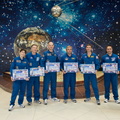
- ISS (WIP) / EXPEDITIONS / EXPEDITION 40
- Source link
- https://www.flickr.com/photos/nasa2explore/albums/72157631560566351/
- भेटी
- 62
- Rating score
- no rate
- Rate this photo
- License
- CC BY-NC-ND
- Modified by WikiArchives
- No (original)
- Downloads
- 1
EXIF Metadata
NIKON CORPORATION NIKON D3S
- Make
- NIKON CORPORATION
- Model
- NIKON D3S
- DateTimeOriginal
- 2014:07:03 12:40:38
- ApertureFNumber
- f/2.8
Powered by Piwigo