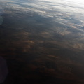
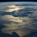
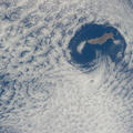
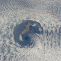
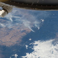
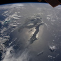
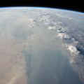
. Small smoke plumes from forest fires onshore are also aligned west. Storm formation near the horizon -- more than 1,000 kilometers away (center) -- is assisted by air currents rising over the central mountains of Borneo.")
WIKIARCHIVES.SPACE
The Human Spaceflight Archive


Information
- Taken in
- Space
- Autor
- NASA
- Kirjeldus
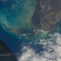
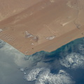
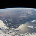
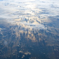
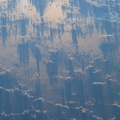
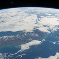
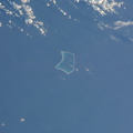
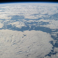
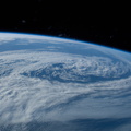
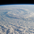
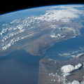
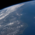
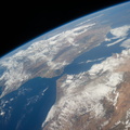
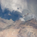
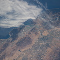
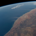
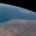
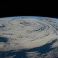
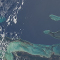
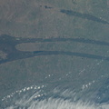
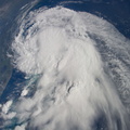
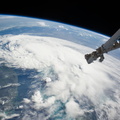
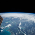
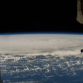
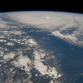
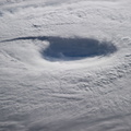
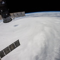
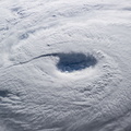
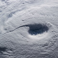
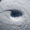
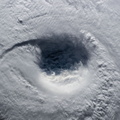
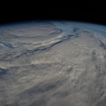
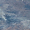
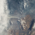
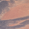
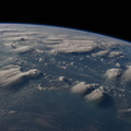
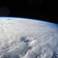
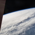
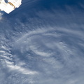
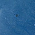
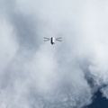
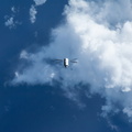
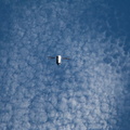
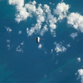
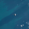
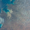
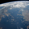
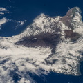
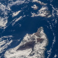
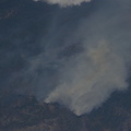
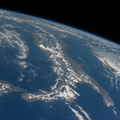
- Thunderheads near Borneo, Indonesia are featured in this image photographed by an Expedition 40 crew member on the International Space Station. Late afternoon sun casts long shadows from high thunderhead anvils over southern Borneo. Crews aboard the space station have recently concentrated on panoramic views of clouds—taken with lenses similar to the focal length of the human eye. These images reveal the kinds of views crews see -- huge areas of the planet, with a strong three-dimensional sense of what it is like to fly 350 kilometers above Earth. Winds usually blow in different directions at different altitudes. High-altitude winds are clearly sweeping the tops off the many tallest thunderclouds, generating long anvils of diffuse cirrus plumes that trail south. At low levels, "streets" of white dots -- fair-weather cumulus clouds -- are aligned with west-moving winds (lower left). Small smoke plumes from forest fires onshore are also aligned west. Storm formation near the horizon -- more than 1,000 kilometers away (center) -- is assisted by air currents rising over the central mountains of Borneo.
- Loodud
- Teisipäev 5 August 2014
- Albumid
- ISS (WIP) / EXPEDITIONS / EXPEDITION 40
- Source link
- https://www.flickr.com/photos/nasa2explore/albums/72157631560566351/
- Külastust
- 77
- Hinnanguskoor
- hindamata
- Hinda seda fotot
- License
- CC BY-NC-ND
- Modified by WikiArchives
- No (original)
- Allalaadimised
- 2
EXIF metaandmed
NIKON CORPORATION NIKON D3S
- Make
- NIKON CORPORATION
- Model
- NIKON D3S
- DateTimeOriginal
- 2014:08:05 09:30:43
- ApertureFNumber
- f/4.0
Toob teieni Piwigo