 and Commander Kevin Kregel make their way to the runway at the Shuttle Landing Facility for a return flight to Houston. During the Jan. 31 launch countdown, Endeavour's enhanced master events controller (E-MEC) No. 2 failed a standard preflight test. Launch was postponed and Shuttle managers decided to replace the E-MEC located in the orbiter's aft compartment. Launch controllers will be in a position to begin the STS-99 countdown the morning of Feb. 6 and ready to support a launch mid- to late next week pending availability of the Eastern Range. The postponed launch gives the crew an opportunity for more training and time with their families. Known as the Shuttle Radar Topography Mission, it will chart a new course to produce unrivaled 3-D images of the Earth's surface, using two antennae and a 200-foot-long section of space station-derived mast protruding from the payload bay. The result could be close to 1 trillion measurements of the Earth's topography. Besides contributing to the production of better maps, these measurements could lead to improved water drainage modeling, more realistic flight simulators, better locations for cell phone towers, and enhanced navigation safety.")
WIKIARCHIVES.SPACE
The Human Spaceflight Archive


Information
- Taken in
- Kennedy Space Center
- Fotograf
- NASA
- Beskrivning
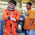
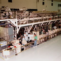
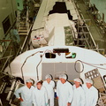
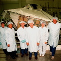
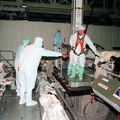
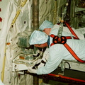
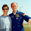
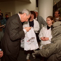
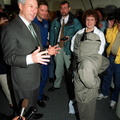
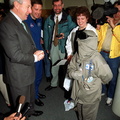
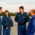
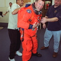
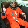
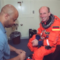
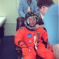
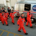
- STS-99 Mission Specialist Gerhard Thiele (foreground) and Commander Kevin Kregel make their way to the runway at the Shuttle Landing Facility for a return flight to Houston. During the Jan. 31 launch countdown, Endeavour's enhanced master events controller (E-MEC) No. 2 failed a standard preflight test. Launch was postponed and Shuttle managers decided to replace the E-MEC located in the orbiter's aft compartment. Launch controllers will be in a position to begin the STS-99 countdown the morning of Feb. 6 and ready to support a launch mid- to late next week pending availability of the Eastern Range. The postponed launch gives the crew an opportunity for more training and time with their families. Known as the Shuttle Radar Topography Mission, it will chart a new course to produce unrivaled 3-D images of the Earth's surface, using two antennae and a 200-foot-long section of space station-derived mast protruding from the payload bay. The result could be close to 1 trillion measurements of the Earth's topography. Besides contributing to the production of better maps, these measurements could lead to improved water drainage modeling, more realistic flight simulators, better locations for cell phone towers, and enhanced navigation safety.
- Skapad den
- Onsdag 2 Februari 2000
- Source link
- https://science.ksc.nasa.gov/gallery/photos/2000/
- Besök
- 39
- Röstpoäng
- inget betyg
- Betygsätt den här bilden
- License
- CC BY-NC-ND
- Modified by WikiArchives
- No (original)
- Nerladdningar
- 0
Baserat på Piwigo