, at right, talks to the media. At left is Mission Specialist Gerhard Thiele (Ph.D.). Thiele is with the European Space Agency and Mohri is with the National Space Development Agency (NASDA) of Japan. Over the next few days, the crew will review mission procedures, conduct test flights in the Shuttle Training Aircraft and undergo routine preflight medical exams. STS-99 is the Shuttle Radar Topography Mission, which will chart a new course, using two antennae and a 200-foot-long section of space station-derived mast protruding from the payload bay to produce unrivaled 3-D images of the Earth's surface. The result of the Shuttle Radar Topography Mission could be close to 1 trillion measurements of the Earth's topography. Besides contributing to the production of better maps, these measurements could lead to improved water drainage modeling, more realistic flight simulators, better locations for cell phone towers, and enhanced navigation safety. Launch of Endeavour is scheduled for Jan. 31 at 12:47 p.m. EST.")
WIKIARCHIVES.SPACE
The Human Spaceflight Archive


Information
- Taken in
- Kennedy Space Center
- Fotograf
- NASA
- Beskrivning
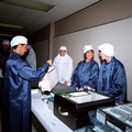
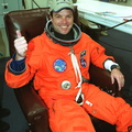
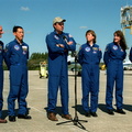
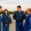
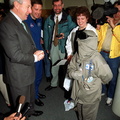
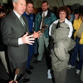
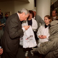
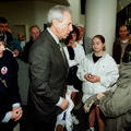
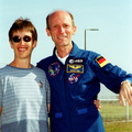
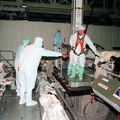
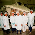
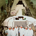
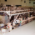
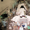
- After the crew arrival at KSC's Shuttle Landing Facility, STS-99 Mission Specialist Mamoru Mohri (Ph.D.), at right, talks to the media. At left is Mission Specialist Gerhard Thiele (Ph.D.). Thiele is with the European Space Agency and Mohri is with the National Space Development Agency (NASDA) of Japan. Over the next few days, the crew will review mission procedures, conduct test flights in the Shuttle Training Aircraft and undergo routine preflight medical exams. STS-99 is the Shuttle Radar Topography Mission, which will chart a new course, using two antennae and a 200-foot-long section of space station-derived mast protruding from the payload bay to produce unrivaled 3-D images of the Earth's surface. The result of the Shuttle Radar Topography Mission could be close to 1 trillion measurements of the Earth's topography. Besides contributing to the production of better maps, these measurements could lead to improved water drainage modeling, more realistic flight simulators, better locations for cell phone towers, and enhanced navigation safety. Launch of Endeavour is scheduled for Jan. 31 at 12:47 p.m. EST.
- Skapad den
- Torsdag 27 Januari 2000
- Source link
- https://science.ksc.nasa.gov/gallery/photos/2000/
- Besök
- 40
- Röstpoäng
- inget betyg
- Betygsätt den här bilden
- License
- CC BY-NC-ND
- Modified by WikiArchives
- No (original)
- Nerladdningar
- 1
Baserat på Piwigo