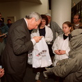
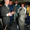
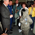
. Pointing to the SRTM are Commander Kevin R. Kregel and Mission Specialist Gerhard Thiele of Germany. Behind them are (left to right) Pilot Dominic L. Pudwill Gorie and Mission Specialists Mamoru Mohri of Japan and Janet Lynn Kavandi (Ph.D.) The remaining crew member (not shown) is Mission Specialist Janice Voss (Ph.D.) Mohri represents the National Space Development Agency of Japan and Thiele represents the European Space Agency. An international project spearheaded by the National Imagery and Mapping Agency and NASA, with participation of the German Aerospace Center DLR, the SRTM consists of a specially modified radar system that will gather data for the most accurate and complete topographic map of the Earth's surface that has ever been assembled. SRTM will make use of radar interferometry, wherein two radar images are taken from slightly different locations. Differences between these images allow for the calculation of surface elevation, or change. The SRTM hardware will consist of one radar antenna in the shuttle payload bay and a second radar antenna attached to the end of a mast extended 60 meters (195 feet) out from the shuttle. STS-99 is scheduled to launch Sept. 16 at 8:47 a.m. from Launch Pad 39A.")
WIKIARCHIVES.SPACE
The Human Spaceflight Archive


Information
- Taken in
- Kennedy Space Center
- Autors
- NASA
- Apraksts
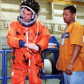
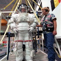
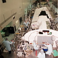
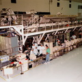
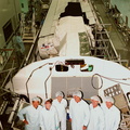
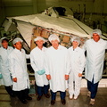
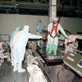
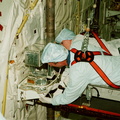
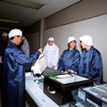
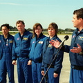
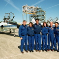
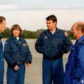
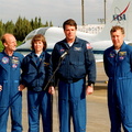
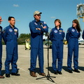
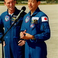
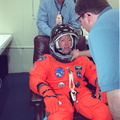
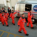
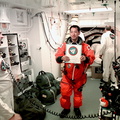
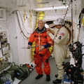
- In the Space Station Processing Facility, the STS-99 crew looks over the payload for their mission, the Shuttle Radar Topography Mission (SRTM). Pointing to the SRTM are Commander Kevin R. Kregel and Mission Specialist Gerhard Thiele of Germany. Behind them are (left to right) Pilot Dominic L. Pudwill Gorie and Mission Specialists Mamoru Mohri of Japan and Janet Lynn Kavandi (Ph.D.) The remaining crew member (not shown) is Mission Specialist Janice Voss (Ph.D.) Mohri represents the National Space Development Agency of Japan and Thiele represents the European Space Agency. An international project spearheaded by the National Imagery and Mapping Agency and NASA, with participation of the German Aerospace Center DLR, the SRTM consists of a specially modified radar system that will gather data for the most accurate and complete topographic map of the Earth's surface that has ever been assembled. SRTM will make use of radar interferometry, wherein two radar images are taken from slightly different locations. Differences between these images allow for the calculation of surface elevation, or change. The SRTM hardware will consist of one radar antenna in the shuttle payload bay and a second radar antenna attached to the end of a mast extended 60 meters (195 feet) out from the shuttle. STS-99 is scheduled to launch Sept. 16 at 8:47 a.m. from Launch Pad 39A.
- Izveidots
- Sestdiena 19 Jūnijs 1999
- Source link
- https://science.ksc.nasa.gov/gallery/photos/1999/
- Apmeklējumi
- 46
- Rezultējošais vērtējums
- nav vērtējuma
- Vērtēt šo foto
- License
- CC BY-NC-ND
- Modified by WikiArchives
- No (original)
- Lejupielādes
- 0
Skripts Piwigo