WIKIARCHIVES.SPACE
The Human Spaceflight Archive

Information
- Taken in
- Space
- Author
- NASA
- Description
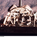
- Lakes Balkhash and Alakol, southern uplands of Kazakhstan, central Asia. The long, 600 kilometers arc of Lake Balkhash occupies the center of this clear west-looking view. The left of the view shows clearly the westernmost Dzungarian Basin in the autonomous region of Xinjiang Uygur (Sinkiang), China. Kazakhstan's capital city Almaty (Alma-Ata) lies out of sight behind the boom. The Dzungarian Gate is the straight, fault-bounded valley cutting through the Dzhungarskiy Alatau Range. The Gate has acted as a major pass for centuries, allowing access between east Asia and central Asia (the valley floor is about 1,500 feet, whereas peaks reach 15,000 feet on the west and about 10,000 feet on the east side) -- it was one of the routes used by the Mongols when they began their invasion of central Asia and Europe in the 13th century. Lake Ebinur is the bright area beneath the dust plume (left center); strong north winds from the steppes of Kazakhstan and Russia are funneled through the Dzungarian Gate where they pick up sediment from dry lakebeds and blow it into China. The Ili River flows westward, parallel to the Dzhungarskiy Alatau Range, through Kapchagay Lake (partially visible beneath boom), then northwest across a large delta plain and into Lake Balkhash.
- Created on
- Albums
- US SPACE PROGRAM / SPACE SHUTTLE / MISSIONS / STS-85 / Mission Photos (Edited)
- Source link
- https://www.flickr.com/photos/nasa2explore/9786223113/in/album-72157635570288026/
- Visits
- 74
- Rating score
- no rate
- Rate this photo
- License
- CC BY-NC
- Modified by WikiArchives
- No (original)
- Downloads
- 0
Powered by Piwigo


