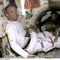
 located just west of the northwest coast of Africa. Low level stratus clouds often form here and become trapped in vertical movement because of an overlaying temperature inversion. The islands create a disturbance in the wind flow, generally from the north or northeast, that create distinctive cloud swirls known as von Karman cloud vortices on the downstream side of the islands. The vertical stabilizer of the Space Shuttle Atlantis dissects the scene.")
WIKIARCHIVES.SPACE
The Human Spaceflight Archive


Information
- Taken in
- Space
- Аутор
- NASA
- Опис
- This image shows a part of the Canary Island group (28 degrees north latitude and 16 degrees west longitude) located just west of the northwest coast of Africa. Low level stratus clouds often form here and become trapped in vertical movement because of an overlaying temperature inversion. The islands create a disturbance in the wind flow, generally from the north or northeast, that create distinctive cloud swirls known as von Karman cloud vortices on the downstream side of the islands. The vertical stabilizer of the Space Shuttle Atlantis dissects the scene.
- Created on
- Категорије
- US SPACE PROGRAM / SPACE SHUTTLE / MISSIONS / STS-101 / Mission Photos (Edited)
- Source link
- https://www.flickr.com/photos/nasa2explore/9366347825/in/album-72157634799027132/
- Посета
- 156
- Оцена резултата
- 4.86 (1 однос)
- Оцени ову слику
- License
- CC BY-NC
- Modified by WikiArchives
- No (original)
- Преузимања
- 0
Урађено у Piwigo