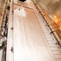
, involves an international project spearheaded by the National Imagery and Mapping Agency and NASA, with participation of the German Aerospace Center DLR. SRTM will chart a new course, using two antennae and a 200-foot-long section of space station- derived mast protruding from its payload bay, to produce unrivaled 3-D images of the Earth's surface. The result of the Shuttle Radar Topography Mission could be close to 1 trillion measurements of the Earth's topography. Besides contributing to the production of better maps, these measurements could lead to improved water drainage modeling, more realistic flight simulators, better locations for cell phone towers, and enhanced navigation safety. STS-99 is scheduled for launch in January 2000.")
WIKIARCHIVES.SPACE
The Human Spaceflight Archive


Information
- Taken in
- Kennedy Space Center
- Author
- NASA
- Description
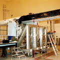
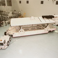
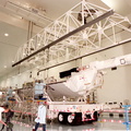
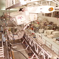
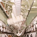
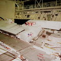
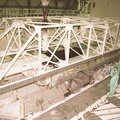
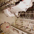
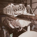
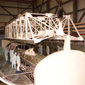
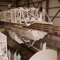
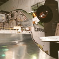
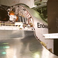
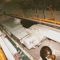
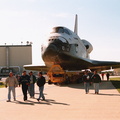
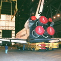
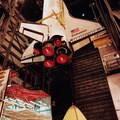
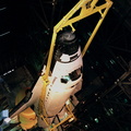
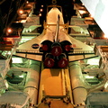
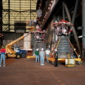
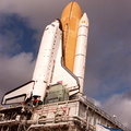
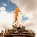
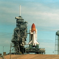
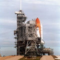
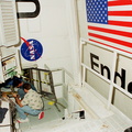
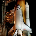
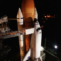
- Under partly cloudy skies and the Atlantic Ocean as a backdrop, Space Shuttle Endeavour, atop the mobile launcher platform, arrives at Launch Pad 39A for mission STS-99. The white cubicle at left is the environmental chamber, the White Room, that provides entry into the orbiter for the astronauts. It is at the outer end of the Orbiter Access Arm on the Fixed Service Structure. STS-99, named the Shuttle Radar Topography Mission (SRTM), involves an international project spearheaded by the National Imagery and Mapping Agency and NASA, with participation of the German Aerospace Center DLR. SRTM will chart a new course, using two antennae and a 200-foot-long section of space station- derived mast protruding from its payload bay, to produce unrivaled 3-D images of the Earth's surface. The result of the Shuttle Radar Topography Mission could be close to 1 trillion measurements of the Earth's topography. Besides contributing to the production of better maps, these measurements could lead to improved water drainage modeling, more realistic flight simulators, better locations for cell phone towers, and enhanced navigation safety. STS-99 is scheduled for launch in January 2000.
- Created on
- Monday 13 December 1999
- Albums
-
Locations / OSM-4.915832801313164
US SPACE PROGRAM / SPACE SHUTTLE / MISSIONS / STS-99 / Rocket preparation
- Source link
- https://science.ksc.nasa.gov/gallery/photos/1999/
- Visits
- 64
- Rating score
- no rating
- Rate this photo
- License
- CC BY-NC-ND
- Modified by WikiArchives
- No (original)
- Downloads
- 1
Powered by Piwigo