WIKIARCHIVES.SPACE
The Human Spaceflight Archive

Information
- Taken in
- Space
- יוצר
- NASA
- תיאור
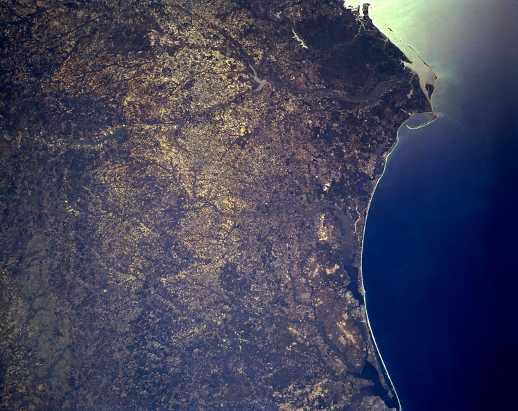
- Vegetation patterns dominate this synoptic, east-looking photograph of the Florida panhandle from Pensacola Bay (bottom right) to the Apalachicola drainage basin and beyond, southern Alabama, and a small section of southwest Georgia. Several south-flowing rivers and their tributaries, distinctive drainage patterns, or floodplains are discernible east of Pensacola Bay—the Apalachicola River (top center) and two of its main tributaries (the Chattahoochee River from the northwest and the Flint River from the northeast); the Walter F. George Reservoir and Lake Seminole (barely visible to the north); and the Choctawhatchee River and its bay. Apparent are dark terrain showing forested lands, especially Apalachicola National Forest east of the Apalachicola River delta, and lighter areas showing more elevated agricultural landscapes.
- Created on
- אלבומים
- US SPACE PROGRAM / SPACE SHUTTLE / MISSIONS / STS-62 / Mission Photos (Edited)
- Source link
- https://www.flickr.com/photos/nasa2explore/9367945492/in/album-72157634790274619/
- ביקורים
- 40
- ציון דירוג
- ללא דירוג
- דרג תמונה זאת
- License
- CC BY-NC
- Modified by WikiArchives
- No (original)
- הורדות
- 0
Powered by Piwigo


