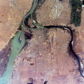
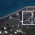
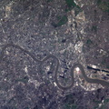
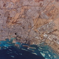
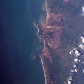
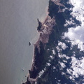
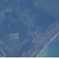
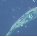
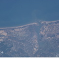
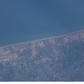
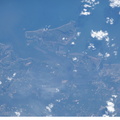
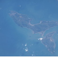
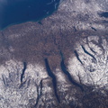
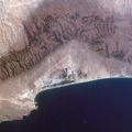
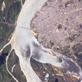
. Located on the broad alluvial fan of the Rimac River, Lima is the capital of Peru and the only mega city (7.7 million inhabitants in 2002) located on the western coastline of South America. The city was established by Francisco Pizarro in 1535 and became an important colonial port linking silver mines of the Altiplano of the high Andes to the east with the burgeoning Spanish empire. During the mid-20th century a significant relocation of people from rural mountain communities into the Lima metropolitan area led to its growth into a mega city. Problems now facing the metropolitan region include development of adequate water resources, control of pollution, and the potential effects of natural hazards such as earthquakes and landslides. This photograph depicts the wealthier San Isidro and Mira Flores quarters of Lima. This part of the metropolitan area is characterized by numerous vegetated parks, golf courses (such as the Lima Golf Course—approximately 1 kilometer long), and greenbelts interspersed with residential and commercial areas. The higher proportion of dark asphalt in the street grid of the residential and commercial areas lends a purple coloration to the left portion of the image (downtown Lima is to the north). Regions with fewer built materials and vegetation are light tan. Wave patterns are visible approaching beaches, popular tourist destinations, in the lower half of the image.")
WIKIARCHIVES.SPACE
The Human Spaceflight Archive


Information
- Taken in
- Space
- Yayımcı
- NASA
- Tanım/Açıklama
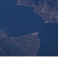
- Lima, Peru is featured in this image photographed by an Expedition 10 crewmember on the International Space Station (ISS). Located on the broad alluvial fan of the Rimac River, Lima is the capital of Peru and the only mega city (7.7 million inhabitants in 2002) located on the western coastline of South America. The city was established by Francisco Pizarro in 1535 and became an important colonial port linking silver mines of the Altiplano of the high Andes to the east with the burgeoning Spanish empire. During the mid-20th century a significant relocation of people from rural mountain communities into the Lima metropolitan area led to its growth into a mega city. Problems now facing the metropolitan region include development of adequate water resources, control of pollution, and the potential effects of natural hazards such as earthquakes and landslides. This photograph depicts the wealthier San Isidro and Mira Flores quarters of Lima. This part of the metropolitan area is characterized by numerous vegetated parks, golf courses (such as the Lima Golf Course—approximately 1 kilometer long), and greenbelts interspersed with residential and commercial areas. The higher proportion of dark asphalt in the street grid of the residential and commercial areas lends a purple coloration to the left portion of the image (downtown Lima is to the north). Regions with fewer built materials and vegetation are light tan. Wave patterns are visible approaching beaches, popular tourist destinations, in the lower half of the image.
- Oluşturuldu
- Salı 15 Mart 2005
- Albümler
- ISS (WIP) / EXPEDITIONS / EXPEDITION 10
- Source link
- https://www.flickr.com/photos/nasa2explore/albums/72157634802502630
- Görüntülenme
- 22
- Oy sayısı
- puan verilmemiş
- Bu fotoğrafa puan ver
- License
- CC BY-NC-ND
- Modified by WikiArchives
- No (original)
- İndirmeler
- 1
Destekleyen Piwigo