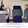
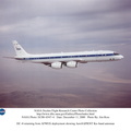
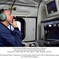
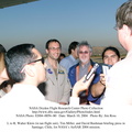
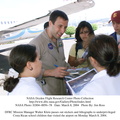
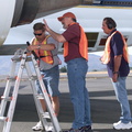
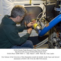
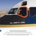
; NASA Administrator Sean O'Keefe; and Fernando Gutierrez, Costa Rican Minister of Science and Technology(MICIT), viewing posters showing how NASA activities have made an impact on Costa Rican people. Mr. O'Keefe was in Costa Rica to participate in the AirSAR 2004 Mesoamerica campaign, which used NASA DFRC's DC-8 airborne laboratory aircraft.
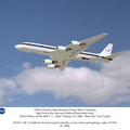
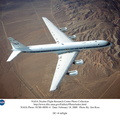
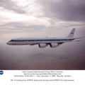
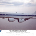
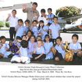
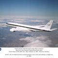
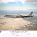
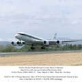
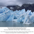
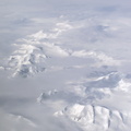
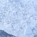
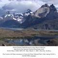
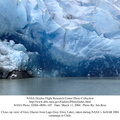
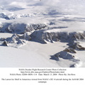
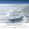
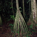
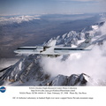
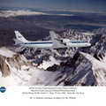
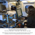
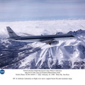
AirSAR 2004 is a three-week expedition by an international team of scientists that will use an all-weather imaging tool, called the Airborne Synthetic Aperture Radar (AirSAR), in a mission ranging from the tropical rain forests of Central America to frigid Antarctica.")
WIKIARCHIVES.SPACE
The Human Spaceflight Archive
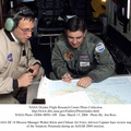
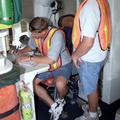
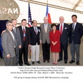
L-R; Jorge Andres Diaz, Director of the Costa Rican National Hangar for Airborne Research division of the National Center for High Technology(CENAT); NASA Administrator Sean O'Keefe; and Fernando Gutierrez, Costa Rican Minister of Science and Technology(MICIT), viewing posters showing how NASA activities have made an impact on Costa Rican people. Mr. O'Keefe was in Costa Rica to participate in the AirSAR 2004 Mesoamerica campaign, which used NASA DFRC's DC-8 airborne laboratory aircraft.


Information
- Taken in
- Edwards Air Force Base
- Egilea
- NASA
- Azalpena
-
L-R; Jorge Andres Diaz, Director of the Costa Rican National Hangar for Airborne Research division of the National Center for High Technology(CENAT); NASA Administrator Sean O'Keefe; and Fernando Gutierrez, Costa Rican Minister of Science and Technology(MICIT), viewing posters showing how NASA activities have made an impact on Costa Rican people. Mr. O'Keefe was in Costa Rica to participate in the AirSAR 2004 Mesoamerica campaign, which used NASA DFRC's DC-8 airborne laboratory aircraft.
AirSAR 2004 is a three-week expedition by an international team of scientists that will use an all-weather imaging tool, called the Airborne Synthetic Aperture Radar (AirSAR), in a mission ranging from the tropical rain forests of Central America to frigid Antarctica.
- Sortuta
- Asteazkena 3 Martxoa 2004
- Albumak
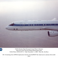
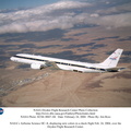
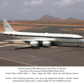
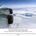
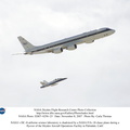
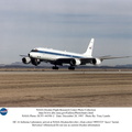
- US SPACE PROGRAM / AERONAUTICS RESEARCH / DC-8
- Source link
- https://www.dfrc.nasa.gov/Gallery/Photo/DC-8/index.html
- Bisitak
- 18
- Kalifikazioa
- baloratu gabe
- Balioestea
- License
- Public Domain
- Modified by WikiArchives
- No (original)
- Deskargak
- 1
Garatzailea: Piwigo